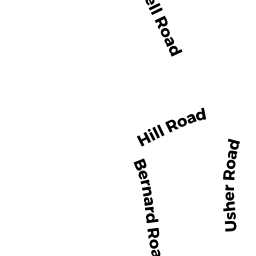
27 REAR ELMROCK DRIVE
Owner Information
WHEELROCK. LLC
997 MILLBURY STREET
WORCESTER, MA 01607


Property Details
27 REAR ELMROCK DRIVE is classified as a Vacant, Conservation (Municipal or County) (Vacant land).
27 REAR ELMROCK DRIVE is valued at $33,300. The land is valued at $33,300 and the structures are valued at $0.
The most recent deed for 27 REAR ELMROCK DRIVE is recorded at the local registrar in Book 60520, Page 236. 27 REAR ELMROCK DRIVE was last sold on Friday, June 7, 2019 for $1,400,000.
Assessment data from fiscal year 2021.
Flood Data
According to the FEMA National Flood Hazard Layer, this property does not appear to be in a flood zone. It may also be in an area not yet reviewed. Nonetheless, confirm this information prior to taking any action.
To view the flood hazards around this property, create a FEMA "Firmette" Map of the area around 27 REAR ELMROCK DRIVE.
Broadband Internet Providers
| Provider | Type | Bandwidth (mbps) | |
|---|---|---|---|
| T-Mobile | Fixed Wireless | 25 | 3 |
| Charter Communications Inc | Cable | 940 | 35 |
| Verizon New England Inc. | Fiber | 940 | 880 |
| Verizon New England Inc. | DSL | 5 | 0 |
| Viasat Inc | Satellite | 100 | 3 |
| GCI Communication Corp. | Satellite | 0 | 0 |
| HughesNet | Satellite | 25 | 3 |
| VSAT Systems, LLC. | Satellite | 2 | 1 |
Broadband service provider data from December 2020.
Adjacent Properties
- 116 BRIGHAM HILL ROAD
Single Family Residential owned by FERRARO, MARGARET A - 29 ELMROCK DRIVE
Single Family Residential owned by WHEELROCK. LLC - 25 ELMROCK DRIVE
Single Family Residential owned by WHEELROCK. LLC - 27 ELMROCK DRIVE
Single Family Residential owned by WHEELROCK. LLC - 116 BRIGHAM HILL ROAD REAR
Vacant, Conservation Organizations (Charitable Org.) owned by GRAFTON LAND TRUST INC